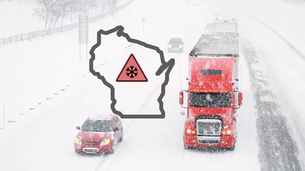
Winter Storm Warning In 21 Wisconsin Counties, Over A Foot Of Snow Expected
This is spring? After an overall mild winter, spring is not playing nice throughout Wisconsin where the National Weather Service has issued 4 Winter Storm Warnings that cover over 20 counties.
Three of the Winter Storm Warnings remain in effect into Wednesday morning, while one will continue into Wednesday afternoon with the potential of bringing over a foot of snow and power outages.
Here are the areas of impact for all warnings that are in effect:
Wisconsin Winter Storm Warning #1
This Winter Storm Warning, which impacts Dane County, will continue into Wednesday morning before eventually transitioning into a Winter Weather Weather Advisory:
- WHAT: For the Winter Storm Warning, heavy snow. Additional snow accumulations of 4 to 7 inches. Winds gusting as high as 35 mph. For the Winter Weather Advisory, snow is expected. Total snow accumulations of up to two inches. Winds gusting as high as 40 mph.
- WHERE: Dane County, including the city of Madison.
- WHEN: For the Winter Storm Warning, until 7 AM CDT Wednesday. For the Winter Weather Advisory, from 7 AM to 1 PM CDT Wednesday.
- IMPACTS: Travel could be very difficult. The hazardous conditions could impact the morning or evening commute.

Wisconsin Winter Storm Warning #2
A similar Winter Storm Warning is in effect for Dodge County and also continues into Wednesday morning before transitioning into a Winter Weather Advisory:
- WHAT: For the Winter Storm Warning, heavy snow. Additional snow accumulations of 5 to 8 inches. Winds gusting as high as 35 mph. For the Winter Weather Advisory, snow is expected. Total snow accumulations of up to two inches. Winds gusting as high as 40 mph.
- WHERE: Dodge County, including the cities of Beaver Dam, Waupun, and Mayville.
- WHEN: For the Winter Storm Warning, until 7 AM CDT Wednesday. For the Winter Weather Advisory, from 7 AM to 1 PM CDT Wednesday.
- IMPACTS: Travel could be very difficult. The hazardous conditions could impact the morning or evening commute.
Wisconsin Winter Storm Warning #3
A third Winter Storm Warning, with more great snowfall accumulations expected, is in effect for Marquette, Green Lake, Fond du Lac, Sauk, and Columbia Counties. It will also become a Winter Weather Advisory on Wednesday morning:
- WHAT: For the Winter Storm Warning, heavy snow. Additional snow accumulations of 6 to 9 inches. Winds gusting as high as 40 mph. For the Winter Weather Advisory, snow is expected. Total snow accumulations of up to two inches. Winds gusting as high as 40 mph.
- WHERE: Marquette, Green Lake, Fond du Lac, Sauk, and Columbia Counties. This includes the cities of Montello, Westfield, Oxford, Neshkoro, Endeavor, Berlin, Princeton, Markesan, Fond Du Lac, Baraboo, Reedsburg, Prairie Du Sac, Sauk City, Portage, Columbus, Lake Wisconsin, and Lodi.
- WHEN: For the Winter Storm Warning, until 7 AM CDT Wednesday. For the Winter Weather Advisory, from 7 AM to 1 PM CDT Wednesday.
- IMPACTS: Plan on slushy road conditions and low visibility for the late afternoon and evening commute.
READ NOW: Horrific Video Released Of The Stabbings On Wisconsin’s Apple River
Wisconsin Winter Storm Warning #4
The fourth Winter Storm Warning is the one that is expected to bring the most treacherous conditions and over a foot of snow. It is in effect until Wednesday afternoon in nearly 20 counties, covering portions of central, east central, north central, and northeast Wisconsin:
- WHAT: Heavy snow expected. Total snow accumulations between 8 and 12 inches, with higher amounts to 14 inches possible in far northeast Wisconsin. Lesser accumulations are possible near the lakeshore in Kewaunee and Manitowoc counties. Winds gusting as high as 45 mph, causing areas of blowing and drifting snow tonight into Wednesday.
- WHERE: Portions of central, east central, north central, and northeast Wisconsin, including the cities of Fish Creek, Manitowoc, Brookside, Aurora, Lakewood, Peshtigo, Little Suamico, Sturgeon Bay, Crandon, Sister Bay, Middle Inlet, Spread Eagle, Crivitz, Kewaunee, Niagara, Harmony, Sobieski, Pensaukee, Antigo, Keshena, Commonwealth, Stevens Point, Neopit, Appleton, Redgranite, Loomis, Oconto, Shawano, Brillion, Menasha, Mountain, Neenah, Waupaca, Green Bay,
Luxemburg, Plover, High Falls Reservoir, Clintonville, Two Rivers, Wausaukee, Townsend, Porterfield, New London, Oshkosh, Chilton, Wautoma, and New Holstein - WHEN: Until 1 PM CDT Wednesday.
- IMPACTS: The strong winds and weight of snow on tree limbs may down power lines and could cause sporadic power outages. Travel could be very difficult to impossible. Areas of blowing snow could significantly reduce visibility. The hazardous conditions could impact the Tuesday evening and Wednesday morning commutes. Gusty winds could bring down tree branches.
The National Weather Service adds that travel is not recommended in any of the areas of impact. People should consider delaying all travel and if travel is necessary, drive with extreme caution.
Taking a winter storm kit along with you, including such items as tire chains, booster cables, flashlights, a shovel, blankets, and extra clothing, is recommended. Those who must travel should also take water, a first aid kit, and anything else that would help them survive in case they become stranded. The latest road conditions are also available by calling 5 1 1.
TIPS: Here's how you can prepare for power outages
Quiz: Do you know your state insect?
Gallery Credit: Andrew Vale
More From B105