Stay Away If An ‘X’ Suddenly Appears On Your Minnesota Property
"X marks the spot", as the old saying goes, although that usually means you've found some sort of treasure.
However, if you're in Minnesota you don't need a treasure map to see an 'X'. In fact, you may see a white 'X' suddenly appear on the road or even have one placed on your property.
What Does It Mean When You See A White 'X' On The Ground?
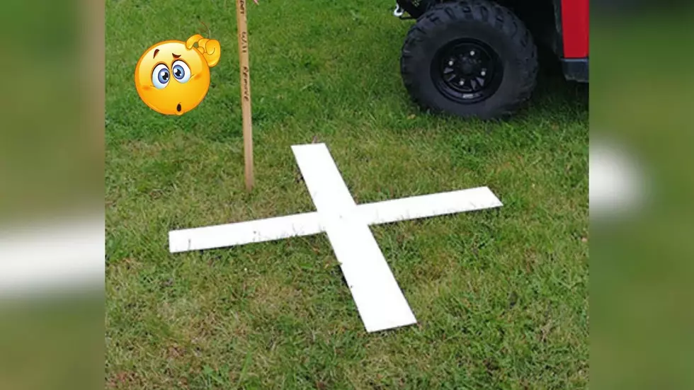
According to the Minnesota Department of Transportation, their crews will paint large white “X” targets on paved surfaces, and place plastic or fabric “X” targets on unpaved surfaces to obtain accurate aerial mapping.
They note that the aerial survey process relies on clear observations and must be conducted after the spring melt and before the trees leaf out. At the beginning of the aerial mapping process, crews place an “X” on the ground as a reference point for the aerial photographer.
A survey crew then records the coordinate position and elevation of the temporary targets for the aerial photography company.
This process is important because it creates a record of existing infrastructure and landscape along MnDOT's right of way for transportation planning and highway design.
What Should You Do Should You Encounter A White 'X'
The Minnesota Department of Transportation says that everyone, including landowners, needs to stay away from any white 'X' that they encounter as they should not be disturbed or removed unless absolutely necessary.

The plastic and fabric targets are temporary and will be removed when the photography is completed. Also, all landowners who are going to have targets placed on or near their property will be contacted directly by MnDOT.
MnDOT Will Be Conducting Aerial Photography On Northwest Minnesota Highways
MnDOT crews will soon begin aerial mapping in northwestern Minnesota. Weather permitting, work will begin in mid-April and conclude in late May.
SEE NOW: Standout Duluth Park Point Home Is Back On The Market
The mapping is scheduled to take place in the following locations:
- Highway 2: Ball Club to Itasca CR 89
- Highway 11: Williams
- Highway 59: Thief River Falls
- Highway 89: Wannaska to Roseau
The Minnesota Department of Transportation will issue press releases whenever a new aerial photography project is scheduled.
LOOK: This is where homes are selling the fastest right now
Gallery Credit: Stacker
QUIZ: Can you identify 50 famous companies by their logos?
More From B105