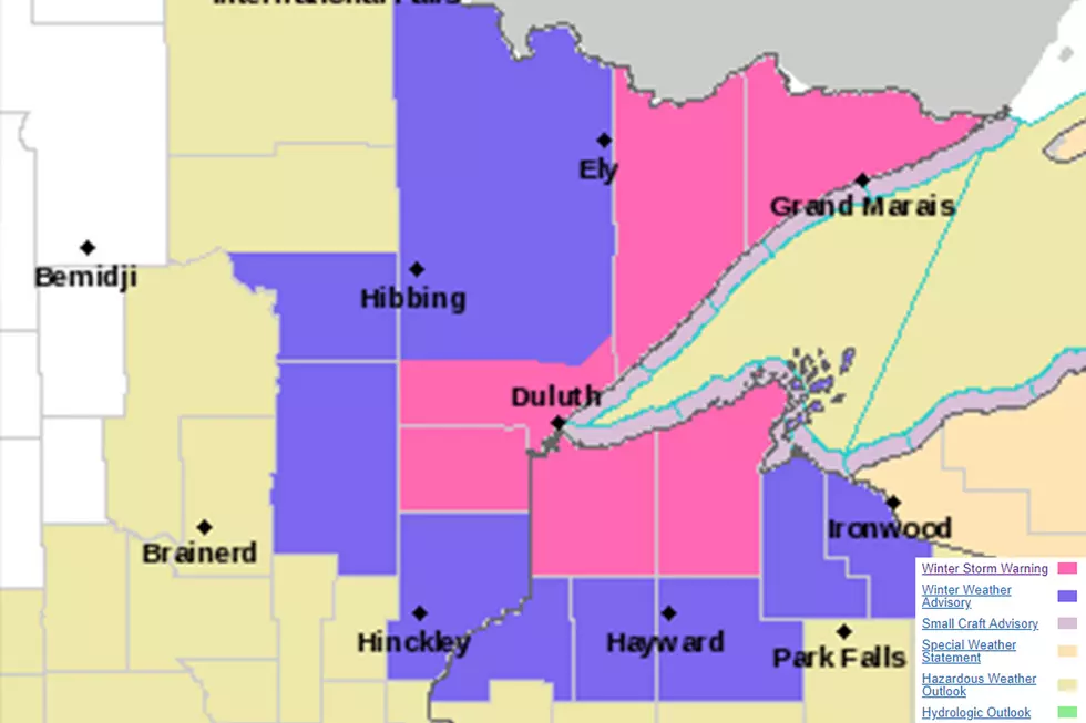
As the path of this week's storm becomes more clear, the National Weather Service has issued a winter storm warning for the Twin Ports and much of our region from early Thursday morning through Friday afternoon.
The National Weather Service has issued a winter storm watch for late Wednesday through Friday morning for the potential of heavy snow and windy conditions that could make for very difficult travel.
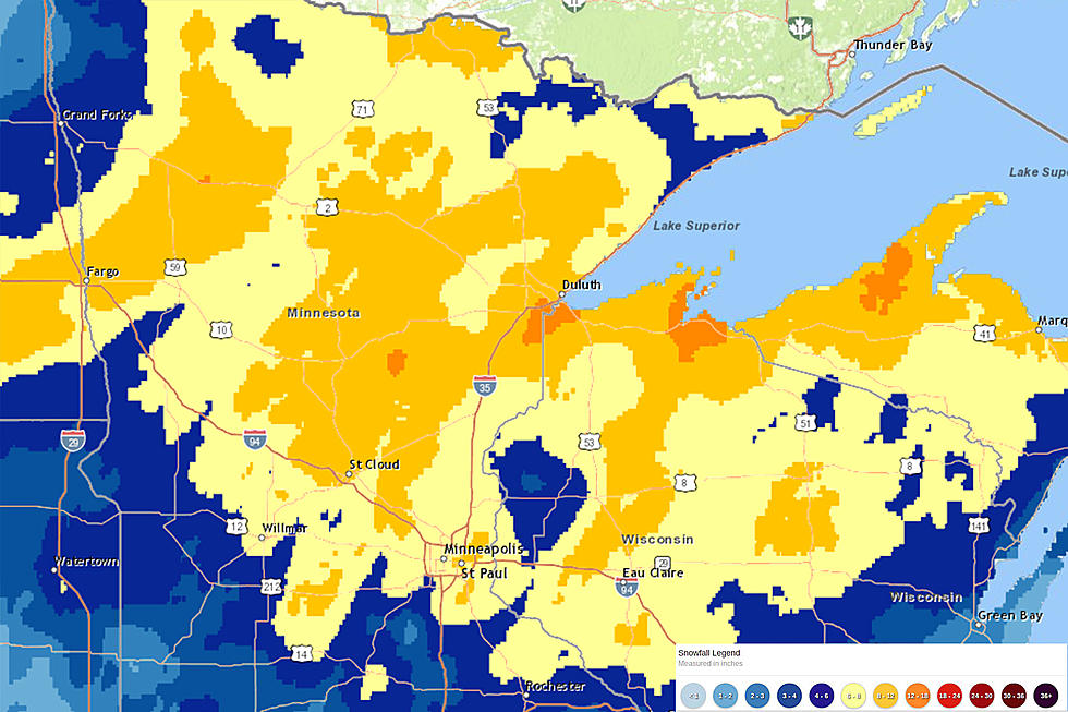
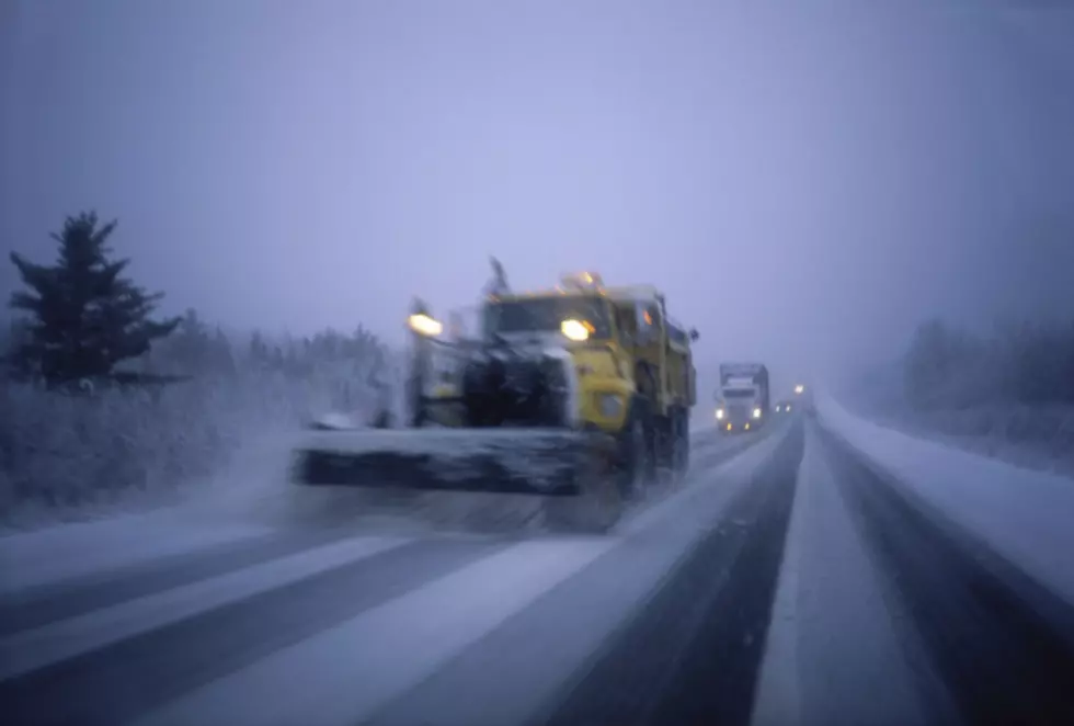
This week's snowstorm brought with it snowfall in excess of a foot in places, and put extra strain on snowplow crews and drivers through the day on Thursday. So, how much did we get around the area?
The National Weather Service has issued a winter storm warning for all of Northeastern Minnesota, effective from Wednesday evening through late Thursday night for heavy snow.
What causes lake effect snow and lake enhancement snow? This video diagram simplifies the scientific process behind this Great Lakes weather phenomenon.
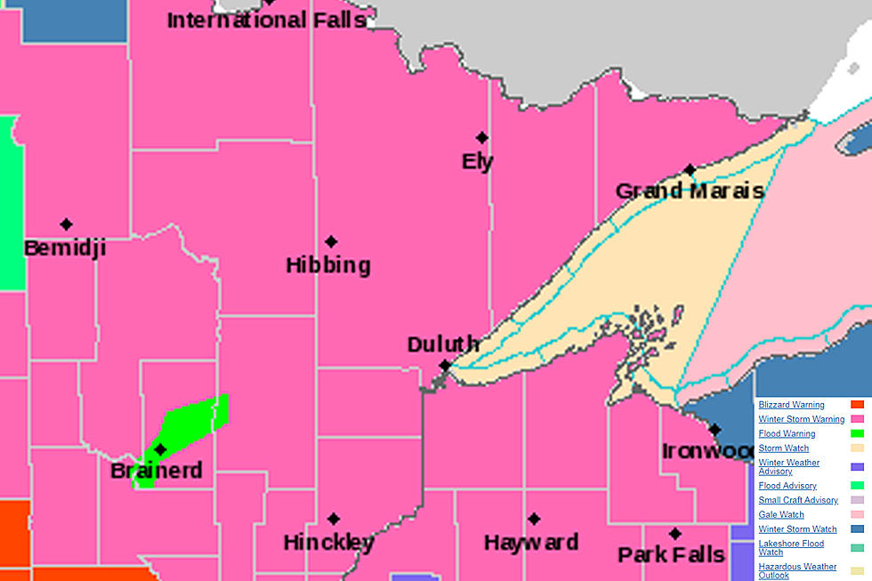
The powerful April storm that has whipped up strong winds through the day on Saturday now looks to bring dangerous winter conditions, prompting the National Weather Service to issue a winter storm warning effective from 7 pm Saturday through 7 am Monday morning.
While Easter usually brings images of blossoming flowers and spring-like weather, this Easter Weekend forecast looks more Christmas-like, with a winter storm watch issued for a storm that could bring 6+ inches of snow to parts of the region.
As the area cleans up from our Thursday night-Friday morning storm, Mother Nature is bringing another, potentially bigger storm into the picture for this weekend.