Officials with the City of Duluth held a press conference Wednesday afternoon to address a number of questions and issues regarding the storm bringing power outages, downed trees, flooding, and damaging waves to Duluth.
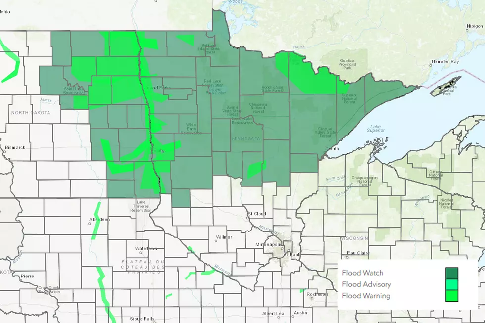
A series of thunderstorms from June 15 through June 17 brought with them 5 or more inches through East Central MN through Northern WI with 10 + inches in places.
A string of thunderstorms bringing with them lots of rain over the last few days has swelled rivers and streams and filled low-lying areas, causing flooding across a number of different parts of Minnesota and Wisconsin.
We got a lot of rain and wet snow in this week's snowstorm. Because of that, a flood advisory has been issued for the St. Louis River in the Scanlon area, as it is expected to reach 10.9 feet, which is slightly higher than the flood stage of 10.5. Minor flooding could occur.
Crews in Superior recently finished repairing the culvert at Barker's Island from the flooding caused by the storms one year ago, almost to the date, but the 2-4 inches of rain that Superior got overnight was enough to cause serious damage for the second year in a row.
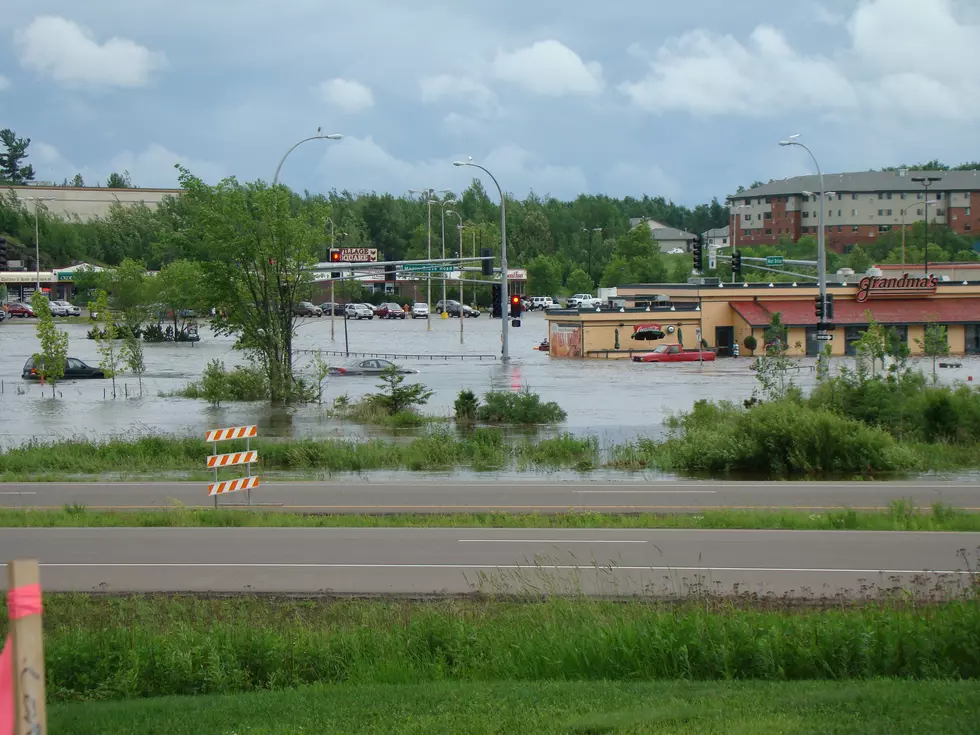
It's been one year since a large storm system dropped several inches of rain on the region; leaving homes, businesses, roadways, and entire communities damaged around the Duluth/Superior region. A year later, we take a look back at some of the incredible photos and videos that left us awestruck.


![Flood Advisory Issued For St. Louis River in Carlton County [VIDEO]](http://townsquare.media/site/150/files/2016/03/RS5078_147243623.jpg?w=980&q=75)
![Barker’s Island Culvert in Superior Damaged by Flood Waters for the Second Year in a Row [PHOTOS]](http://townsquare.media/site/164/files/2013/06/ZS8uLUV-Imgur.jpg?w=980&q=75)